
Regulation & EUDR
What good EUDR plot-level geolocation and DDS evidence looks like
Practical guide to plot-level geolocation and DDS evidence under EUDR — geometry rules, consent, source lists through mixes, and reusable compliance records.
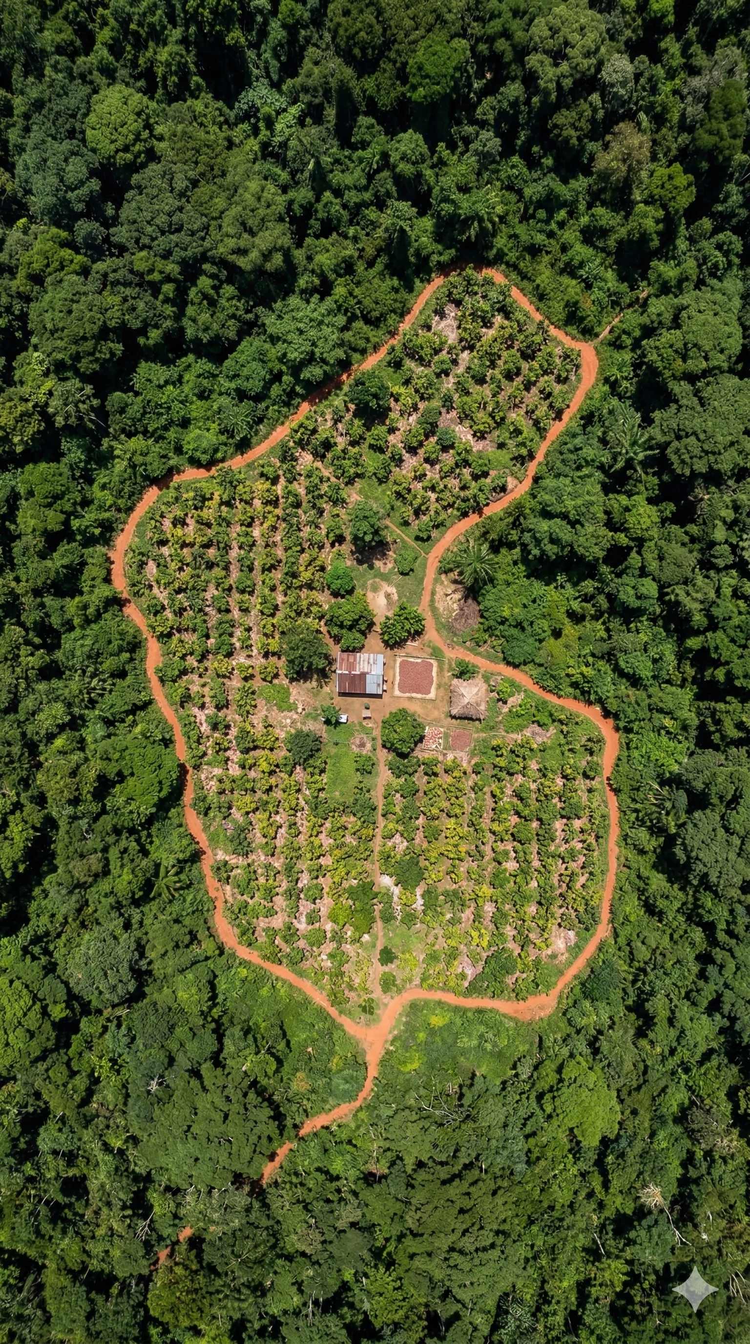
Operators placing relevant products on the EU market — or exporting them — need plot-level geolocation in the due diligence statement (DDS). That is not a nice-to-have. It is how the EU Deforestation Regulation (EUDR) links a shipment to the land where the commodity was produced.
This piece answers a practical question: what does *good* plot-level geolocation and DDS evidence look like? Not in theory. In the shape of data you can reuse across buyers and programmes.
Start with what the Regulation actually asks for
Regulation (EU) 2023/1115 and the Commission's FAQ set clear geometry rules.
Coordinates. Geolocation means latitude and longitude with at least six decimal digits.
Points vs polygons. For plots of land larger than 4 hectares (commodities other than cattle), you need a polygon that traces the perimeter. For plots under 4 hectares, a single point or a polygon is allowed. Cattle establishments use a point.
One plot per polygon. FAQ 1.14 is explicit: each polygon should indicate one single plot of land. If a product comes from several plots, you provide several polygons in one DDS. You do not draw one big outline around a mix of plots and empty land.
No circumference workaround. A centre point plus a radius is not accepted as a substitute for a perimeter polygon.
Mixing does not erase origin. When compliant goods from many places of production are mixed (silo, tank, stack, continuous process), the declared places of production must cover all goods that could be in the shipment — not a cherry-picked subset. Mass-balance chains that mix deforestation-free material with unknown or non-compliant material are not allowed.
Those rules define the evidence package. Satellite layers and risk maps help you *check* claims. They do not replace plot coordinates collected for the land that actually produced the commodity.
What "good" evidence looks like in practice
Good plot-level evidence is more than a GPS pin on a map. It is a package that survives handoffs.
1. Geometry that matches the plot
- One plot → one geometry (point or polygon, as size requires).
- Closed, valid polygons (no self-intersections, no holes the Information System cannot process).
- Six decimal digits, not four.
- Area that reflects the production plot — not an administrative region or a cooperative boundary used as a shortcut.
2. Identity that ties geometry to a producer and a product
You need enough producer and plot identity so the geometry is not orphaned. Who farms it? Which commodity? Which harvest window or production period? Without that link, a polygon is just a shape.
3. Consent and provenance
Field data often includes personal or farm identifiers. Consent to collect, store, and share for compliance use should travel with the record. So should a simple provenance trail: who captured it, when, with what device or method, and whether it was corrected later.
4. Source lists that survive mixes
When volumes from many plots enter the same logistics step, your source list must still list every plot that could contribute. FAQ 1.17 walks through silo-style cases. The practical takeaway: your field records and your shipment logic must stay connected. If you only keep "the plots we think went into this truck," you are not ready for a mix.
5. Reusable packages across buyers
Many smallholders sell into more than one channel. Many exporters serve more than one EU buyer. If every buyer re-maps the same farm, farmers pay the cost in time and trust. Good evidence is collected once at the plot, then moulded into the package each buyer or programme needs — without starting over.
That is program data readiness: field-first capture → reusable records → packages shaped for EUDR (and, later, for other schemes) without double-asking the farmer.
Field-first rails — not satellite-only
Remote sensing is useful. Operators and authorities may cross-check geolocation against satellite imagery and forest maps. Remotely sensed information can help verify whether declared land is linked to deforestation after the cut-off date.
But the Regulation's starting point for the DDS is the geolocation of the plots of production. Those coordinates can be collected with phones, handheld GNSS devices, and common GIS apps. The Commission FAQ notes that this does not require mobile network coverage — only a solid GNSS signal.
So a practical approach is:
- Capture in the field — walk or mark the plot with the farmer present, offline if needed.
- Store as a reusable record — geometry, identity, consent, capture metadata.
- Verify and correct — fix bad polygons before they enter a DDS pipeline.
- Assemble DDS-ready packages — select the plots linked to a volume, keep source lists intact through mixes, export in formats the Information System can use (e.g. GeoJSON).
- Reuse — same records, different buyer packs or programme views, without remapping.
Satellite-only workflows miss the farmer conversation, consent, and the "which plot fed this bag?" link. Field-only workflows without reuse force remapping for every programme. The useful middle is field-first rails with reusable compliance records.
How Tracebud frames this
Tracebud is built around farmer-first field data collection that leads to program data readiness. In practice that means offline plot mapping, consent at capture, cascading network requests so partners can ask for missing pieces without starting from zero, and reusable EUDR-ready compliance records that can be moulded for different buyers and programmes.
Ops, Network, and Agency shells help different actors work on the same underlying records. Delivery vs Cover packs are one way to think about what gets shared for a specific programme need versus what stays as the durable field record.
We do not claim this is the only way to meet EUDR. It is a practical approach to what operators need: plot geometries that match the FAQ, source lists that survive mixes, and packages you can reuse instead of recollecting.
A short checklist before you call a package "DDS-ready"
- Every contributing plot has geometry (point or polygon per size rules).
- Polygons are one-plot-one-polygon (FAQ 1.14).
- Coordinates meet six-decimal precision.
- Producer/plot identity and production timing are attached.
- Consent and capture provenance are recorded.
- For mixed logistics, the declared source list covers all plots that could be in the volume.
- The package can be reused for another buyer without remapping the farm.
If you want to see how field-first capture turns into reusable compliance records, visit Tracebud.com.
Sources
- Regulation (EU) 2023/1115 on deforestation-free products — EUR-Lex (consolidated): https://eur-lex.europa.eu/legal-content/EN/TXT/?uri=CELEX:02023R1115-20251226
- European Commission, Frequently Asked Questions – Implementation of the EU Deforestation Regulation (Version 5, April 2026), esp. §§1.1, 1.3–1.5, 1.8, 1.14, 1.16–1.18: https://environment.ec.europa.eu/document/download/744919a7-8650-4850-89ad-a597268cd69e_en?filename=FAQ-UPDATE-5th-Iteration+FINAL.pdf
- European Commission Green Forum — Deforestation Regulation implementation hub: https://green-forum.ec.europa.eu/nature-and-biodiversity/deforestation-regulation-implementation_en
- EUDR Information System — GeoJSON file description (Operator API reference): https://eudr.webcloud.ec.europa.eu/tracesnt/help/eudr-documentation/operator/geojson-description.html